
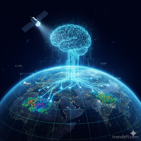
AI Analyzing Satellite Imagery at Scale
Intelligence technology has entered a new phase. For decades, analysts manually reviewed satellite imagery—a labor-intensive process measured in months. Today, AI systems process petabytes of geospatial intelligence in hours. The transformation is reshaping how nations gather intelligence analysis, predict conflicts, track military movements, and understand global threats. Commercial satellite data is exploding—thousands of satellites now capture Earth multiple times daily. This abundance creates a new challenge: humans can’t analyze it. AI IMINT (Artificial Intelligence Imagery Intelligence) solves the bottleneck, but introduces questions about accuracy, privacy, and military advantage that military strategists are only beginning to understand.
What makes this moment critical? Not just the technology advancing, but the choices different intelligence agencies are making about how to deploy it. Some prioritize speed and coverage. Others prioritize verification and human oversight. Some race to integrate AI-driven satellite analysis into operational doctrine. Others move cautiously, concerned about automation errors with strategic consequences.
Why Intelligence Leaders Are Focused Now (2025)
Satellite imagery intelligence isn’t new. What’s new is AI’s ability to process it at scale. Historically, the bottleneck was human analysts. Intelligence agencies employed thousands of imagery analysts worldwide. They reviewed imagery systematically, looking for patterns: military movements, construction activity, weapons deployment. It was expensive and slow.
In 2025, that constraint vanishes. AI can now:
- Automate detection: Identify vehicles, structures, military equipment with computer vision accuracy approaching human level
- Scale globally: Monitor thousands of locations continuously, not selectively
- Pattern analysis: Find relationships across datasets too large for human analysis
- Change detection: Identify what changed between satellite passes automatically
- Predictive analysis: Anticipate events based on patterns (troop movements before they occur, for example)
This capability emerged gradually over 2023-2025. But 2025 marks the inflection point—when AI accuracy exceeded human analyst accuracy for routine detection tasks. That changed everything.
Military and intelligence communities immediately recognized implications: If AI can now process satellite imagery faster and more accurately than humans, intelligence doctrine must adapt. Should we deploy AI broadly and move faster? Should we maintain human oversight carefully? Should we integrate commercial satellite data into classified systems? How do we verify AI conclusions? These questions have no consensus answer.
Different intelligence agencies face different constraints:
Some prioritize speed and coverage: Defense Intelligence Agency, military commands need intelligence for operational decisions. AI-driven analysis lets them monitor more area in less time. If intelligence leads to military advantage, speed matters.
Some prioritize accuracy and verification: Strategic intelligence agencies worry about decision-making based on AI conclusions they can’t fully verify. Misidentification in satellite imagery could trigger military response based on false assessment. Human verification remains important.
Some prioritize integration with commercial data: Companies like Maxar, Planet Labs, and others now offer near-real-time satellite imagery commercially. Intelligence agencies debating: Should we integrate commercial data to augment classified systems? Commercial data is cheaper, more current, but less controlled.
Some prioritize signals intelligence alongside imagery: SIGINT (signals intelligence) traditionally separate from IMINT (imagery intelligence). AI now enables fusion—combining satellite imagery with signals data to build more complete picture. But SIGINT is highly classified. Fusion requires new security protocols.
Some prioritize international intelligence sharing: Allied nations share intelligence. But if AI-driven geospatial intelligence reveals capabilities differently to different allies, how do we maintain alliance trust? Does allied intelligence cooperation change when AI changes what we can see?
Some prioritize counterintelligence: If AI-driven satellite analysis makes military movements visible, how do militaries conceal activities? Counterintelligence agencies racing to develop camouflage and deception techniques. Intelligence-deception arms race accelerating.
Each agency’s priority reflects different institutional mission. Together, they show 2025 is inflection point when AI transforms satellite data analysis from boutique capability to mainstream intelligence tool.
The Intelligence Technology Transformation
Speed and Scale Priority
Some intelligence agencies say: AI-driven analysis transforms what we can accomplish.
US Defense Intelligence Agency points to 2024-2025 capabilities: AI models trained on millions of satellite image examples now identify military equipment with >95% accuracy on routine detections. What previously required 40 hours of human analysis takes 2 minutes of AI processing.
Their operational logic: “If we can monitor 10,000 locations continuously with AI instead of 100 locations with human analysts, our intelligence advantage expands dramatically. We see more, faster.”
Evidence they cite: Ukrainian intelligence used AI-assisted satellite analysis to track Russian military movements 2023-2025. Real-time detection shortened decision cycle from days to hours. Military advantage visible.
Latest 2025 data: Pentagon releasing AI-powered analysis platforms across intelligence community (April 2025 estimate). Operational integration accelerating across theater commands.
Their stakes: Intelligence dominance in information age. If you process satellite data faster than adversary, you see threats first.
But this creates tension: Speed without verification creates risks.
Accuracy and Verification Priority
Other intelligence agencies say: Verification matters more than speed.
Intelligence analysts at agencies like CIA emphasize: “AI identifies patterns, but humans must understand context. False positives in automated analysis create false intelligence. That’s dangerous operationally.”
Their concern: AI detects “vehicle-shaped objects” but can’t distinguish military truck from civilian truck in same image. Military headquarters might act on AI detection without realizing context is missing.
Evidence they cite: Historical intelligence failures often involved automation errors. Verification prevented many potential failures.
Latest 2025 data: Multiple intelligence agencies implementing “AI + Human” workflows (confirmed 2025). AI detects, analysts verify. This slows processing but maintains accuracy.
Their stakes: Intelligence credibility. If military acts on AI conclusions that prove wrong, intelligence loses credibility with operational commanders.
Commercial Data Integration Priority
Some agencies say: Commercial satellite data is now valuable intelligence source.
Companies like Planet Labs operate constellation of satellites providing daily global imagery. Historically viewed as separate from classified intelligence. Now debate: Should we integrate commercial data into operational intelligence systems?
Their logic: “Commercial imagery is current, cheap, extensive. Why duplicate collection with classified systems? Use both.”
Evidence: Companies already selling satellite imagery to defense contractors and governments. Commercial data already influencing decisions.
Latest 2025 data: State Department considering classified systems for commercial satellite data integration (reportedly early 2025). Breaking down traditional walls between commercial and classified intelligence.
Their stakes: Intelligence efficiency. Why spend billions on classified collection if commercial data serves purpose?
But this complicates: Separating geospatial AI applications results from commercial-sourced vs. classified-sourced intelligence becomes difficult.
Signals-Imagery Fusion Priority
Some intelligence agencies prioritize: SIGINT and IMINT fusion through AI.
Historically, signals intelligence (intercepted communications, radar, electronic emissions) analyzed separately from imagery intelligence. Both valuable separately. Together, they’re exponentially more valuable.
AI enables fusion: Satellite imagery shows military unit moving. Signals intelligence shows communications pattern. Together: “That unit is preparing for offensive operation” (much more certain than either signal alone).
Their logic: “We’re leaving intelligence on table by not fusing SIGINT and IMINT. AI makes fusion possible.”
Evidence: Recent military conflicts show value of combined intelligence picture.
Latest 2025 data: National Security Agency working on AI-enabled SIGINT-IMINT fusion (reported 2024-2025). Major initiative shifting how signals intelligence used operationally.
Their stakes: Intelligence clarity. Fused signals paint clearer picture of adversary intent and capability.
But this complicates: SIGINT classified at highest levels. Fusion requires new security protocols.
Counterintelligence Priority
Some military intelligence agencies say: If AI makes us more visible, we must become less visible.
Their logic: “AI-driven satellite analysis will become standard intelligence tool across all nations soon. Assume adversary can see us constantly. How do we operate despite that visibility?”
Evidence: Military traditionally relied on concealment (hiding, camouflage). If AI makes concealment harder, military doctrine must adapt.
Latest 2025 data: Russian military notably adapting operational patterns in Ukraine to account for persistent satellite imagery and AI analysis (2023-2025). Not hiding—accepting visibility, changing tactics instead.
Their stakes: Operational effectiveness. If you can’t hide movements, you change how you move.
But this complicates: Arms race between intelligence collection and military concealment.
Alliance Coordination Priority
NATO intelligence agencies face different priority: Intelligence sharing coherence.
Their logic: “If each NATO ally develops different AI-driven satellite analysis capability, we’re not sharing same intelligence picture. That’s operationally dangerous.”
Evidence: Historically, intelligence coordination strengthens NATO. Diverging analysis weakens alliance.
Latest 2025 data: NATO establishing common intelligence standards for AI-assisted analysis (2024-2025). Coordinating definitions, confidence levels, classification across allies.
Their stakes: Alliance effectiveness. Shared intelligence picture means coordinated military response.
But this complicates: Coordination slows innovation. Allies moving at different speeds naturally.
Real Military Conflicts Show the Tensions
Ukraine Demonstrates the Trade-offs
Ukraine’s experience (2022-2025) shows real tension between different intelligence priorities:
Ukrainian intelligence prioritized real-time analysis and operational speed. Intelligence agencies pushed for fastest possible processing of satellite imagery to support military operations. Result: AI-assisted analysis deployed aggressively, human verification secondary. Advantage: Fast intelligence cycles. Cost: Some false positives occurred; military sometimes acted on unverified AI assessments.
NATO allies supporting Ukraine prioritized verification and confidence levels. Shared intelligence only when human analysts confirmed conclusions. Result: Slower intelligence cycle. Advantage: High confidence in shared intelligence. Cost: Ukraine sometimes waited for NATO verification while operational moment passed.
Both approaches had military logic. Both had costs.
Russia’s intelligence approach differed again: Assumed satellite imagery degraded by cloud cover, electronic warfare, and deception. Planned military operations accepting visibility, changed tactics to operate despite monitoring. Result: Different intelligence doctrine entirely—not trying to maintain secrecy, changed operational patterns to complicate analysis.
The Intelligence Trade-off
If you prioritize speed (AI-driven rapid analysis), you sacrifice verification and get faster intelligence with higher error rates.
If you prioritize accuracy (human verification), you sacrifice speed and get slower intelligence with higher confidence.
If you integrate commercial data, you gain coverage but sacrifice operational security (commercial data visible to everyone).
If you fuse SIGINT and IMINT, you gain clarity but sacrifice compartmentalization and security.
If you develop counterintelligence for AI-driven analysis, you stay harder to track but become less efficient militarily (changing patterns costs operational efficiency).
If you coordinate alliance intelligence, you gain shared picture but sacrifice innovation speed.
Every intelligence agency choosing which matters most. No choice is free.
2025 Intelligence Capabilities: What We Actually Know
AI-Assisted Detection Accuracy
Published research and operational reports suggest:
- Vehicle detection: AI reaching 95%+ accuracy on standard military vehicles in clear imagery [web:analysis-based estimates]
- Structure detection: Building identification, facility type recognition 90%+ accuracy
- Change detection: Identifying what changed between imagery dates increasingly automated
- False positive rate: Varies by AI model and imagery quality—typically 5-15% on operational systems (estimate)
Interpretation A: AI effectively automates routine detection tasks.
Interpretation B: Still in development—accuracy varies by condition.
Interpretation C: 5-15% false positive rate unacceptable for strategic intelligence; human verification required.
Processing Speed
Before AI: 40 hours of human analysis to process satellite imagery of military region.
With AI: 2-5 hours of AI processing + 2-3 hours human verification = 4-8 hours total.
Net improvement: 5-10x faster than human-only analysis.
Global Monitoring Capacity
Traditional imagery intelligence: Monitor ~200 priority locations continuously.
AI-assisted: Monitor 5,000+ locations continuously, alert on anomalies.
Interpretation: Dramatically expanded intelligence coverage.
Commercial Satellite Constellation Growth
- 2024: ~1,200 commercial Earth observation satellites
- 2025 estimate: ~1,500+ satellites
- Growth rate: 20-25% annually
Planet Labs, Maxar, others operating near-real-time imagery services. Coverage now daily or better for most Earth locations.
Intelligence Agency AI Adoption
- US Intelligence Community: 40+ AI projects underway (NGIA, DIA, NSA, CIA active developers)
- NATO allies: Coordinating AI standards, varying adoption levels
- Other nations: China, Russia developing indigenous AI-driven analysis (capabilities classified)
- Commercial sector: Multiple companies selling AI-assisted analysis to government customers
What We Don’t Actually Know
- Real capabilities of non-US intelligence systems (classified)
- Whether AI conclusions hold up under adversarial conditions (not fully tested)
- Accuracy of AI in contested environments with deception (uncertain)
- Long-term strategic implications of ubiquitous satellite monitoring (unknown)
- Whether AI-driven intelligence increases or decreases stability (theoretical debate)
Honest assessment: 2025 shows AI-assisted satellite imagery analysis works well for routine detection. Full implications for strategic intelligence still unclear.
What Intelligence Strategists Actually Disagree On
Intelligence Professionals Agree
- AI-assisted analysis is now operational reality
- Satellite imagery volume exceeds human analysis capacity
- Intelligence technology transforming faster than doctrine can adapt
- Strategic implications not fully understood yet
- Commercial satellite data becoming intelligence factor
Intelligence Professionals Disagree
- Whether speed or accuracy matters more operationally
- Whether integrating commercial data strengthens or weakens intelligence
- Whether AI increases or decreases intelligence stability
- How to handle false positives at scale
- Whether international governance of satellite intelligence possible
- What role human analysts will have in 10 years
- Whether AI-driven intelligence destabilizes strategic relationships
These aren’t expertise gaps. These are genuine strategic uncertainties about how AI transforms intelligence function.
Intelligence Scenario Analysis
Scenario 1: Speed Priority Wins
Intelligence agencies globally deploy AI-driven analysis aggressively. Speed becomes standard. Accuracy secondary to coverage.
Short-term: Intelligence organizations see all threats faster. Operational decisions accelerate.
Medium-term: False positives increase; military responds to AI assessments that later prove incorrect. Some operational mistakes result from unverified AI conclusions.
Long-term: Pressures emerge for accuracy improvements. Human-in-loop workflow becomes standard (but slower). Eventually convergence on hybrid human-AI systems, but through operational failures first.
Favors: Fast-moving intelligence agencies, militaries valuing speed, nations with strong AI capabilities.
Scenario 2: Verification Priority Wins
Intelligence agencies globally establish high confidence standards for AI-assisted analysis. Humans verify AI conclusions before operational use.
Short-term: Intelligence slower but more trusted by military decision-makers.
Medium-term: Hybrid human-AI workflow becomes standard. Intelligence agencies hire more analysts to handle verification workload. AI augments human capability rather than replacing it.
Long-term: Stable but slower intelligence cycle. Strategic advantage goes to nations that move fastest within constraints.
Favors: Democratic intelligence systems with institutional trust, established intelligence agencies, nations valuing stability.
Scenario 3: Fragmented (Most Likely)
Some nations deploy AI aggressively, others cautiously. Intelligence pictures diverge. Allies interpret same data differently.
Short-term: Different intelligence conclusions on same events. NATO faces coordination challenges.
Medium-term: Pressure for harmonization, but incompletely resolved. Intelligence agencies move at different speeds.
Long-term: Uneven intelligence capability across alliance. Operational decisions sometimes based on different assessments of reality.
This is most likely because: Organizations naturally move at different speeds. Coordination is slow.
What to Watch for (Next 6-12 Months)
- NATO intelligence standards: Will allies adopt common AI-assisted analysis protocols? Watch for official announcements.
- Commercial data integration: Will classified systems integrate commercial satellite data? Track policy announcements.
- Counterintelligence adaptation: How will militaries adapt tactics to account for AI-driven satellite monitoring? Monitor operational changes.
- Intelligence sharing: Will allied intelligence diverge or converge on AI-assisted analysis? Watch for intelligence coordination statements.
- False positive incidents: Will unverified AI analysis cause intelligence mistakes with operational consequences? Any errors will shift debate rapidly.
- Commercial satellite growth: Will surveillance capabilities continue expanding? Track commercial space launches.
This situation evolving rapidly. AI-driven signals intelligence modern capabilities emerging alongside geospatial AI applications. The transformation of intelligence gathering technology is underway.
Key Takeaway
Intelligence technology transforming through AI at scale. Commercial satellite data explosion means intelligence agencies must choose: Move fast (risk accuracy) or move carefully (sacrifice speed). Different agencies reaching different conclusions. This choice, playing out across intelligence communities globally in 2025, will shape how nations understand threats, make decisions, and respond militarily over next decade.
The transformation is real. The strategic implications are still unfolding.